Estimating Distance from a NASA Image
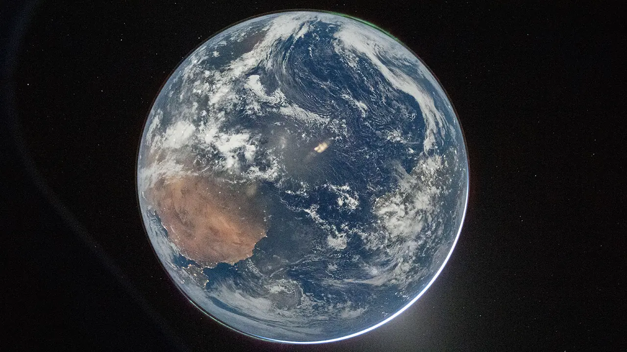
On April 2, 2026, NASA released a photograph of Earth taken from the Orion spacecraft during Artemis II.1
Using only the image file and its EXIF metadata, we can estimate how far the spacecraft was from Earth at the moment the picture was taken. This is a practical example of combining metadata, optics, and geometry.
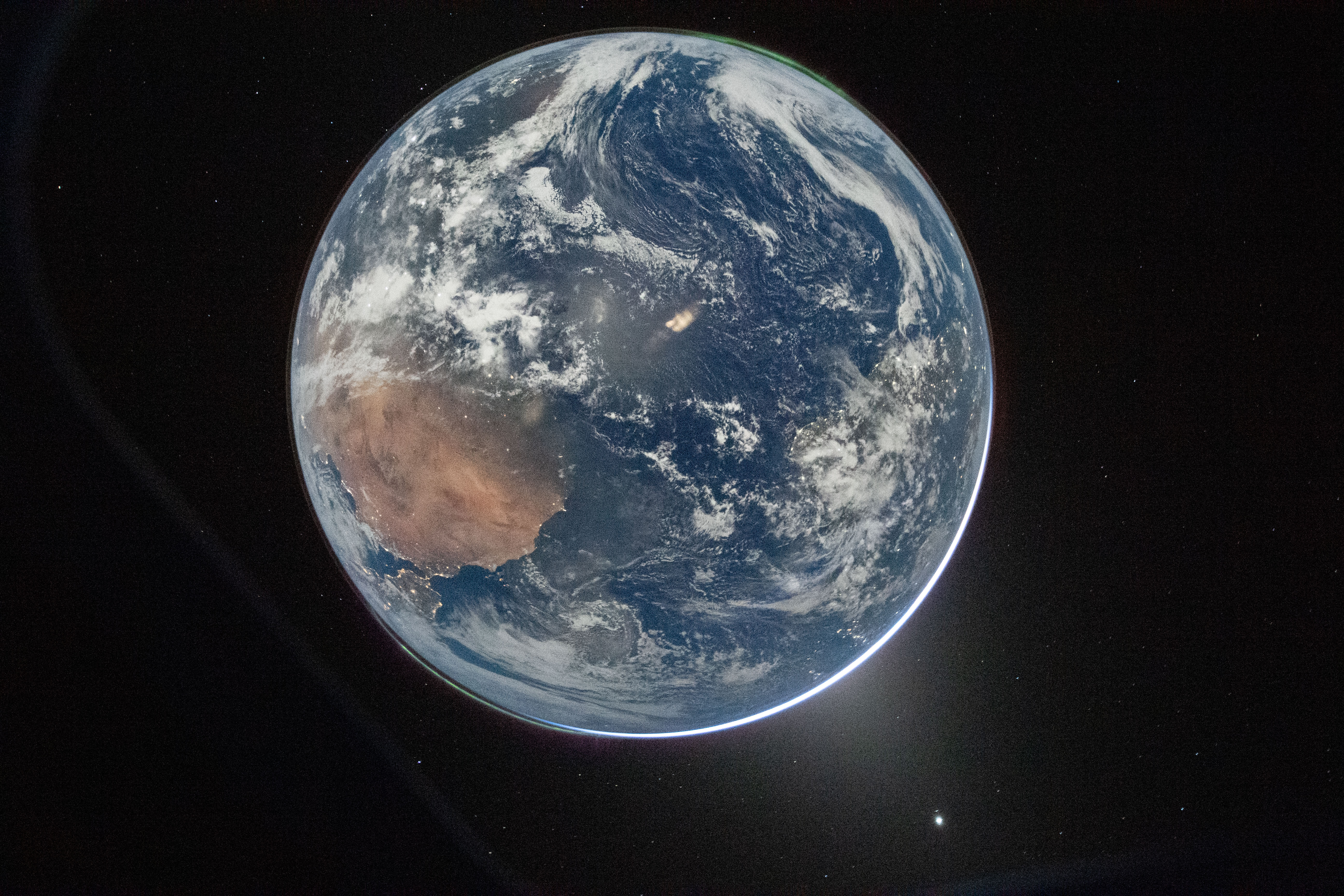
Image credit: NASA / Reid Wiseman. Public domain.
Key Metadata
From the original image file (art002e000192.jpg):
- Resolution: 5568 x 3712 px
- Measured Earth diameter: 2896 px
- Camera: Nikon D5 (full-frame sensor)
- Lens: 14-24 mm f/2.8
- Focal length: 22.0 mm
- Horizontal field of view (derived): $\approx 78.58^\circ$
The field of view is derived from focal length and sensor size using:
FOV = 2 x arctan(sensor_width / (2 x focal_length))
For a 36 mm full-frame sensor and 22 mm focal length, this yields $\approx 78.58^\circ$, matching EXIF.
Angular Diameter of Earth
For a rectilinear lens, the angular size is:
\[\theta = 2 \arctan\left(\frac{D_e}{W} \cdot \tan\left(\frac{\mathrm{FOV}}{2}\right)\right)\]Where:
- $D_e$ = Earth diameter in pixels
- $W$ = image width in pixels
Substitute values:
\[\frac{D_e}{W} = \frac{2896}{5568} \approx 0.5201\] \[\tan(39.29^\circ) \approx 0.8182\] \[\theta \approx 2 \arctan(0.5201 \cdot 0.8182) \approx 46.1^\circ\]Distance from Earth's Center
Using Earth radius $R = 6371\,\mathrm{km}$:
\[d = \frac{R}{\tan(\theta/2)}\] \[\tan(23.052^\circ) \approx 0.4255\] \[d \approx \frac{6371}{0.4255} \approx 14972\,\mathrm{km}\]Altitude
\[h = d - R \approx 14972 - 6371 \approx 8601\,\mathrm{km}\]Final Results
- Angular diameter: $\approx 46^\circ$
- Distance from Earth center: $\approx 14972\,\mathrm{km}$
- Altitude: $\approx 8601\,\mathrm{km}$
Interpretation
The measured angular size places the spacecraft well above Low Earth Orbit ($\approx 400\,\mathrm{km}$), yet still far from the Moon ($\approx 384000\,\mathrm{km}$). This corresponds to a high Earth orbit, consistent with an early translunar phase.
Assumptions and Uncertainty
This estimate relies on a few simplifying assumptions:
- Rectilinear projection for the lens
- Earth approximated as a sphere
- Minor influence from atmosphere, clouds, and lens distortion
Estimated uncertainty: $\pm 2-5 \%$ ($\approx \pm 300-750\,\mathrm{km}$)
Conclusion
From the EXIF metadata and the measured size of Earth in the frame, it is possible to infer:
- The angular size of Earth in the image
- The spacecraft’s distance from Earth
- A plausible point along its trajectory
The image itself contains enough information to approximate the spacecraft’s position at the moment it was taken.
-
Source of the NASA photograph: Hello, World - NASA. Photo by NASA / Reid Wiseman. Public domain. ↩